
Home / Mapping & Photogrammetry
Why fly the survey instead of walking it
A full site mapped in one flight, not days of ground traverse
GPS-geotagged to real-world coordinates on every flight
The same flight path, every visit — progress you can actually compare
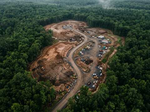
WHAT WE DELIVER
01
Orthomosaic map
A single stitched, geo-rectified image of the whole site.
02
Digital elevation model
Surface and terrain elevation, contour-ready.
03
3D point cloud & mesh
Dense, measurable 3D data of structures and terrain.
04
Volumetric & stockpile reports
Cut/fill and stockpile volumes, calculated from the scan.
05
Progress comparison overlays
The same flight path, every visit — change tracked side by side.
PROCESS
Request to delivered map
01
Request comes in
Tell us the site and the output you need.
02
Flight plan set
Grid pattern mapped to the site, no ground crew needed.
03
Grid flight captured
80%+ overlap, full site coverage.
04
Data processed & delivered
Orthomosaic, models, and reports in 48–72h.
What's in your hands after
Orthomosaic map (GeoTIFF)
Digital elevation / surface model
3D point cloud (LAS/LAZ)
Volumetric & stockpile report, on request
Raw imagery included
View a sample report (PDF)
Need a site mapped or surveyed?
Same-day reply — most mapping flights are scheduled within the week.